
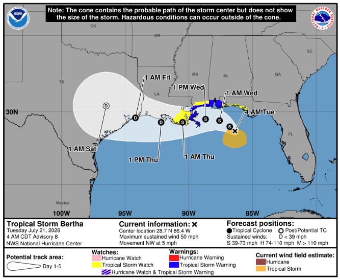
Tropical Storm Bertha was “stationary” on the night of July 20 as federal forecasters warned it could bring tropical storm conditions, heavy rainfall and coastal flooding to parts of the northern Gulf Coast in the coming days.
Bertha, the second named storm of the Atlantic hurricane season, intensified from a tropical depression on July 20, according to the National Hurricane Center.
The storm was located about 140 miles south of Panama City, Florida, and about 215 miles southeast of Mobile, Alabama, as of the hurricane center’s 10 p.m. CDT advisory. Bertha had maximum sustained winds of 40 mph.
Forecasters said a slow west-northwestward or westward movement is expected during the next several days, with Bertha forecast to move near or along the northern Gulf Coast. Some additional strengthening is possible through July 21.
Tropical storm watches were in effect along the Gulf Coast, where strong winds, heavy rain and dangerous surf conditions could develop late July 20 into July 21, according to the hurricane center. A storm surge watch was in effect from the Alabama-Florida border to the mouth of the Mississippi River.
Forecasters advised authorities and residents in Louisiana and Texas to monitor the progress of the storm, as “additional watches or warnings could be required for portions of that area” on July 21.