
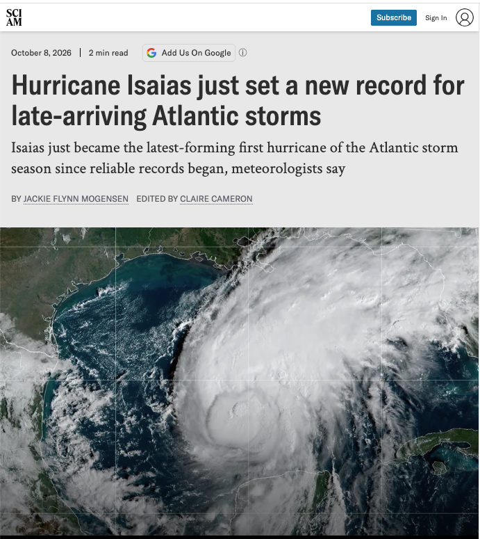
Isaias is officially the first hurricane of this year’s Atlantic season—marking the latest arrival of a first hurricane in the region since reliable tracking began.
As of this writing, the Category 1 hurricane is about 385 miles (620 kilometers) off the U.S. Gulf Coast and is expected to make landfall late on Friday or early on Saturday, according to the National Oceanic and Atmospheric Administration. Isaias’s winds are currently about 80 miles per hour (130 kilometers per hour), with “additional strengthening” expected before landfall, NOAA said in its recent forecast.
As Scientific American previously reported, the Atlantic hurricane season has been historically quiet this year. That’s in no small part because of a strong, brewing El Niño, which typically dampens Atlantic hurricanes with unfavorable wind conditions. The region had seen no hurricanes form between June and September—an unparalleled dry spell.
Officials officially upgraded Isaias’s status from a tropical storm to a hurricane—a storm with wind speeds at or above 74 mph (119 kph)—at 3:30 A.M. UTC on October 8. According to meteorologists, that’s the latest first hurricane since satellite tracking began. (Prior to that, a hurricane that didn’t make landfall could go unnoticed, making it hard to say if this is the latest-forming storm for the region ever.)
Still, Isaias beat the previous record by a stunning 27 days, hurricane researcher Brian McNoldy wrote on social media.
“There was beginning to be some uncertainty about whether the Atlantic would get any hurricanes at all this season, but having the first one occur so late in the season is undoubtedly a result of the very strong El Niño building in the central Pacific Ocean,” McNoldy tells Scientific American. “Activity in the deep tropical Atlantic has been shut down this year due to the El Niño–induced wind shear, so the Gulf is one of the few places where this could happen.”
Like any hurricane, Isaias poses a real danger: Officials have put a hurricane warning—meaning, extreme wind and rain conditions are expected—in effect for parts of Mississippi, Alabama and Florida. Dangerous storm surge is possible from Louisiana to the Florida Panhandle. There is also the possibility of “isolated tornadoes” in parts of Alabama, Florida and southwestern Georgia, according to NOAA.
“Preparations to protect life and property should be rushed to completion,” the agency said.
Editor’s Note (10/8/26): This is a breaking news story and may be updated.